
Original Aerial Documentary
Istanbul From Above: Aerial Documentary Journey Across the Bosphorus
Original Istanbul drone footage filmed by Bourbiza Mohamed for Euro News Agency on 22 February 2024 using DJI Mini 3 Pro.
Watch the Documentary
ENA Istanbul Aerial Documentary
Original aerial footage filmed by Bourbiza Mohamed for Euro News Agency in Istanbul, Türkiye, on 22 February 2024 using DJI Mini 3 Pro.
The first seconds of this Istanbul drone footage begin with a simple truth: the city cannot be understood from one street or one monument. From above, Istanbul opens as movement. Water cuts through the frame. Ferries cross in different directions. Tramlines and roads carry evening traffic along the waterfront. The skyline rises in layers, with towers, apartment blocks, mosque domes and minarets appearing as part of a living urban rhythm.
This original aerial documentary was filmed in Istanbul, Türkiye, on 22 February 2024 by Bourbiza Mohamed for Euro News Agency, using a DJI Mini 3 Pro. It is a field document shaped by height, weather, dusk, water traffic and changing light. It follows Istanbul through blue hour and sunset, moving between waterfront roads, illuminated mosques, Galata Tower, the Bosphorus, the Maiden’s Tower, ferries and bridges.
The result is an Istanbul travel documentary from the air, and a study of how the city behaves at the end of the day. Vehicles slow and gather. Ferries leave white trails across darkening water. Minarets become silhouettes, then illuminated markers. Public squares fill with pedestrians. The Bosphorus becomes both visual axis and working corridor.
Why Istanbul Is One of the World’s Most Fascinating Cities From the Air
Istanbul is often described as a city between Europe and Asia, but from the air that statement becomes visible rather than abstract. The footage repeatedly returns to water as the central structure of the city. The Bosphorus, the waterfront roads, the ferry routes and the bridges all show Istanbul as a place where geography still directs daily life. Roads do not simply run through the city; they bend toward the water. Boats are not decorative; they are part of the transport system. Mosques and towers do not sit outside the city; they rise from neighborhoods that are still active, crowded and lived in.
From above, the historical importance of Istanbul becomes easier to read. The camera captures tightly packed roofs, streets descending toward the waterfront, domes and minarets above commercial streets, and modern high-rises in the distance. The city is not a museum, but a working metropolis where history and contemporary life share the same frame.
The aerial perspective also reveals scale. The skyline stretches across hills. Traffic moves in lines of white and red light. Ferries cross open water while buses, taxis and trams continue along the shore. The footage shows why Istanbul from above is so compelling for documentary filmmakers: the city offers architecture, movement, atmosphere and geography in a single visual language.
Filming Istanbul With DJI Mini 3 Pro
Filming a major international city from the air requires patience before it requires altitude. With a DJI Mini 3 Pro, the advantage is mobility and stable aerial framing in changing light. In this footage, the vertical format emphasizes height, waterfront depth and the relationship between foreground traffic and distant skyline. It works well for Istanbul because the city rises in stacked planes: water, roads, people, domes, towers and sky.
The filming conditions visible in the footage are those of late day and early evening. The sky shifts between pale blue, clouded grey, warm orange and deep blue. Visibility is good enough to show long views across the water, but the clouds add texture and drama, especially in the sunset sequences where mosque silhouettes and illuminated streets become stronger visual elements.
The camera movement is mostly observational rather than aggressive. The drone holds elevated viewpoints, glides slowly, tilts over waterfront roads, and frames landmarks with enough time for viewers to read the scene. That restraint matters because Istanbul already contains visual complexity: ferries, streets, mosque courtyards, bridges, towers, pedestrians, buses, taxis and waterfront lights.
Specific camera settings are not asserted here because they are not visible from the published file. What the footage does show is a careful use of exposure during a difficult time of day. Sunset and blue hour can easily produce blown skies or dark foregrounds. In these scenes, the image retains the warm sky, the illuminated architecture and the movement of traffic and boats, which is essential for travel filmmaking in Istanbul.
Scene-by-Scene Analysis of the Documentary Footage
The documentary opens above a waterfront road, looking down toward traffic, tramlines and the Bosphorus. Yellow taxis, cars and a tram move through the lower part of the frame, while the water fills the middle distance. Across the water, the skyline rises in a pale evening haze. This opening establishes the central theme of the footage: Istanbul as a city of transport, water and layered urban life.
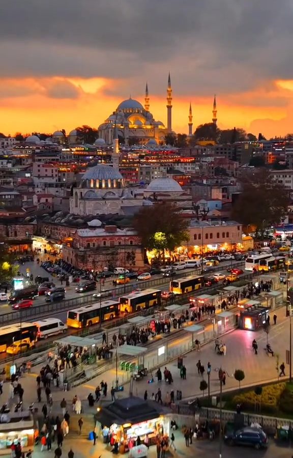
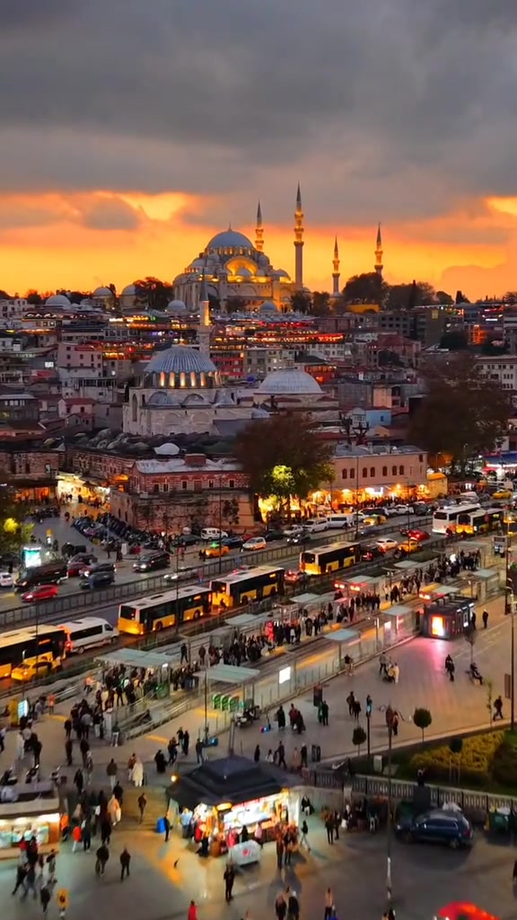
The next sequence moves closer to a district where a large mosque dominates the upper frame. Traffic flows below, including buses and taxis, while the mosque’s minarets rise above the surrounding streets. The camera angle gives equal importance to sacred architecture and ordinary city movement. It is not only a landmark shot; it is a city operating around its landmarks.
The footage then shifts to a bridge and waterfront restaurant area, with boats moving across the water and pedestrians gathered along the railings. The bridge is busy at several levels: traffic above, people walking, lights from dining areas, and water below. From an aerial documentary perspective, this is one of the clearest visual examples of Istanbul’s density. Public life, transport and tourism all appear in the same vertical frame.
Galata Tower appears in warm evening light, its stone body and conical roof illuminated against a soft sky. The drone frames the tower with the Bosphorus behind it and compact rooftops below. This is one of the most cinematic moments in the footage because the tower acts as a visual anchor between the historic neighborhood and the water beyond. Later, Galata Tower returns from different angles, surrounded by apartments, streets and the glow of early evening.
Several scenes focus on mosque silhouettes at sunset. The sky becomes orange and dramatic, with dark clouds above and warm light behind the domes and minarets. Below, streets, buses and pedestrians continue moving. The contrast is powerful: sacred architecture stands still while the modern city flows around it. The footage uses this contrast repeatedly, not as nostalgia, but as a documentary observation of Istanbul’s identity.
As the film progresses, the camera opens wider over waterfront districts, showing marinas, ferry piers, boats and dense neighborhoods. The blue of the water deepens. White ferry lights and streetlights begin to define the scene. Aerial visibility remains strong enough to show how the shoreline curves and how urban life follows that curve.
The Bosphorus Bridge sequence is one of the clearest statements of Istanbul’s two-continent geography. In the foreground, Ortaköy Mosque stands by the water with its dome and minarets lit warmly. Behind it, the bridge spans the Bosphorus, its cables rising into the evening sky. The composition is strong because it places Ottoman waterfront architecture and modern infrastructure in the same shot. This is Istanbul in one frame: heritage, water, engineering and motion.
Another important sequence shows the Maiden’s Tower, with the Turkish flag visible on top and boats moving around it. The tower sits in the water as ferries pass behind and beside it. The sky is darker here, with dramatic clouds and late sunset color. The image feels quieter than the traffic-heavy scenes, but it is not still. The surrounding boats continue to move, reminding the viewer that even Istanbul’s iconic monuments are part of a living waterway.
The final scenes move further into blue hour. A waterfront road curves along the Bosphorus, crowded with cars, pedestrians and lights. A tall tower-like structure and the bridge lights appear in the background. Later shots return to illuminated mosque architecture and dense rooftops. The atmosphere becomes more nocturnal, but the city does not slow down. The documentary ends with Istanbul still moving: water traffic, street traffic, people, lights and architecture all continuing after sunset.
The Bosphorus: The Waterway Connecting Two Continents
The Bosphorus is not only scenery in this footage. It is the organizing force of the film. Nearly every major scene relates to the water: roads beside it, bridges above it, towers within it, boats crossing it, mosques facing it, neighborhoods descending toward it. From the air, the Bosphorus becomes a visual map of Istanbul’s identity.
The footage shows passenger ferries, smaller boats, larger vessels and waterfront piers. Some boats move slowly across the frame; others create bright trails or reflections as the light fades. This movement gives the documentary a natural rhythm. The drone does not need to manufacture drama because the water already carries it.
For international viewers, these Bosphorus aerial views explain Istanbul more effectively than a street-level shot alone. They show why the city has always been strategically important: it sits where continents, trade routes, maritime movement and imperial history meet. But the footage also shows the contemporary Bosphorus as a daily working route, not only a symbol.
Istanbul’s Architectural Identity
The architecture visible in the footage is a study in contrast. Domes and minarets appear throughout the film, sometimes in warm light, sometimes under blue-grey clouds, sometimes glowing after sunset. Galata Tower stands as a vertical historic marker above dense residential rooftops. Waterfront mosques, including the clearly visible mosque at Ortaköy, are framed against bridges and moving water.
Modern Istanbul is also present. High-rise buildings appear across the water in the opening skyline. Roads, tramlines, buses and bridge infrastructure define many of the compositions. The footage does not isolate heritage from urban development. Instead, it shows how Istanbul’s architectural identity depends on overlap.
This is one reason Istanbul drone footage can be so visually rich. A single shot can contain Ottoman forms, modern transport, apartment facades, water traffic, commercial streets and distant towers.
Travel Filmmaking Opportunities in Istanbul
For travel filmmakers, Istanbul offers rare visual density: landmark sequences, transport movement, blue-hour atmosphere, waterfront life and human scale. The footage demonstrates strong opportunities for documentary storytelling through aerial approaches to mosques, slow reveals of towers, bridge compositions, boat movement, traffic patterns and sunset transitions.
The best visual opportunities are not limited to famous monuments. In this film, some of the strongest frames are transitional: a tram beside the water, pedestrians on a bridge, ferries under a clouded sky, taxis near a mosque and lights turning on across a waterfront road.
Drone cinematography in Istanbul works best when it respects the city’s complexity. The camera should look for relationships: tower and water, bridge and mosque, ferry and skyline, road and public square, sunset and streetlight.
Personal Notes From the Field
Filming Istanbul from above on 22 February 2024, I was reminded that the city changes character minute by minute. In late afternoon, the water carried pale light. As evening approached, mosques and towers became stronger silhouettes. Then the city lights appeared, and Istanbul shifted into a warmer, denser visual language.
What impressed me most while filming was the movement. The ferries did not stop. The roads did not empty. People continued to gather along the waterfront and around the bridges. Even when the camera was high above the city, the human scale remained visible. The drone gave altitude, but the story stayed close to daily life.
The DJI Mini 3 Pro allowed me to work with discretion and mobility, but the real discipline was observation. Istanbul does not need exaggerated camera movement. It needs patience. The city reveals itself through layers: a ferry behind a tower, a mosque under a dark cloud, a bridge holding the horizon, a tram moving toward the water. Those moments have to be seen, filmed and interpreted.
Responsible Drone Flying in Türkiye
Responsible drone filming begins before takeoff. In a city such as Istanbul, safety, permissions, privacy, weather, airspace awareness and respect for people must come before any image. Drone pilots should check current Turkish aviation rules, local restrictions and any requirements affecting urban areas, heritage sites, crowds, waterfront operations and major infrastructure.
The footage in this documentary is presented as travel journalism and visual storytelling, not as encouragement to fly without preparation. Istanbul includes sensitive locations, dense public spaces, busy waterways and complex airspace considerations. A responsible filmmaker must avoid risky flight paths, respect heritage sites, maintain safe distance from people and structures, and treat the city as a living environment rather than a visual playground.
Good drone filming in Turkey is not only technical. It is ethical. The goal is to document place with care.
Why Original Footage Matters in Modern Travel Journalism
Original footage is central to credible travel journalism because it provides visual evidence. It shows what was actually observed: the weather, the light, the traffic, the boats, the skyline, the atmosphere, the density of streets and the behavior of a place at a specific moment. In this case, the footage was filmed by Bourbiza Mohamed for Euro News Agency on 22 February 2024. That field context matters.
In an era of generic destination content, original aerial footage strengthens editorial authority. It supports first-hand reporting and E-E-A-T principles: experience, expertise, authoritativeness and trust. The filmmaker has been present, has observed the conditions and can describe the city from direct visual evidence.
For tourism professionals, original content also helps distinguish real destination storytelling from promotional repetition. Istanbul does not need invented drama. The documentary evidence is already powerful: ferries crossing the Bosphorus, Galata Tower at dusk, mosque silhouettes under orange clouds, Ortaköy by the bridge, Maiden’s Tower surrounded by boats, and a city still moving after night begins.
Conclusion
This Istanbul aerial documentary is a portrait of a city shaped by water, architecture and motion. It follows transitions: afternoon into sunset, sunset into blue hour, streets into waterfront, towers into bridges, mosques into modern traffic, ferries into open water.
From the air, Istanbul becomes both grand and intimate. The Bosphorus carries the scale. The ferries carry the rhythm. The mosques and towers carry history. The roads, trams, taxis and crowds carry the present. Filmed with DJI Mini 3 Pro for Euro News Agency, this original footage offers more than a view from above. It offers a documentary reading of Istanbul as it lives, moves and glows at the edge of night.
FAQ
What does this Istanbul drone footage show?
It shows Istanbul from above at sunset and blue hour, including the Bosphorus, waterfront roads, ferries, Galata Tower, mosque silhouettes, Ortaköy Mosque, the Bosphorus Bridge, Maiden’s Tower, traffic and illuminated urban districts.
Who filmed the Istanbul aerial documentary?
The footage was filmed by Bourbiza Mohamed, Founder, Director & Executive Producer of Euro News Agency.
When was the Istanbul drone footage filmed?
The footage was filmed on 22 February 2024 in Istanbul, Türkiye.
What drone was used to film Istanbul from above?
The footage was filmed using a DJI Mini 3 Pro.
Is this article based on original footage?
Yes. The article is based on the visible scenes in the original Euro News Agency aerial footage, not on generic destination descriptions.
What makes Istanbul strong for drone filming?
Istanbul offers water, skyline, bridges, historic towers, mosque architecture, ferries, traffic movement and dramatic sunset light within the same urban landscape.
Does the footage show the Bosphorus?
Yes. The Bosphorus appears throughout the documentary, with ferries, boats, waterfront roads, bridge views and city districts on both sides of the water.
Does the video include Galata Tower?
Yes. Galata Tower appears prominently in several aerial scenes, framed with surrounding rooftops and the water beyond.
Explore more from Euro News Agency:
Location Information
Location: Istanbul, Türkiye
Date Filmed: 22 February 2024
Publisher: Euro News Agency
Author: Bourbiza Mohamed
Equipment
Drone: DJI Mini 3 Pro
Format: Vertical aerial documentary
Video Duration: 3 minutes 20 seconds
Copyright: Euro News Agency
Author
Bourbiza Mohamed
Founder, Director & Executive Producer at Euro News Agency. International Travel Journalist, Documentary Filmmaker and Drone Videographer.